DataLink: The Unique Data Integration Solution
Imagine every engineer, every geologist having access to a single, easy-to-use application that provides them with direct access to all of your data repositories. Imagine live links to every database and every flat-file data archive combined with integrated GIS and 3D viewing capabilities. Most importantly, imagine that all of this is possible with no data migrations. DataLink works directly from your existing databases and flat-file archives.
This is DataLink by Ditegra.

According to IDC, knowledge workers spend nearly 30 percent of their workday, searching for information. Infocentric Research estimates that more than 50 percent of all engineering decisions are made with incomplete, inconsistent or inadequate information. DataLink is the proven, innovative solution that solves both of these critical E&P Industry problems.

DataLink: View all your E&P data instantly from one application
Integrate Mapping, GIS and 3D Functionality
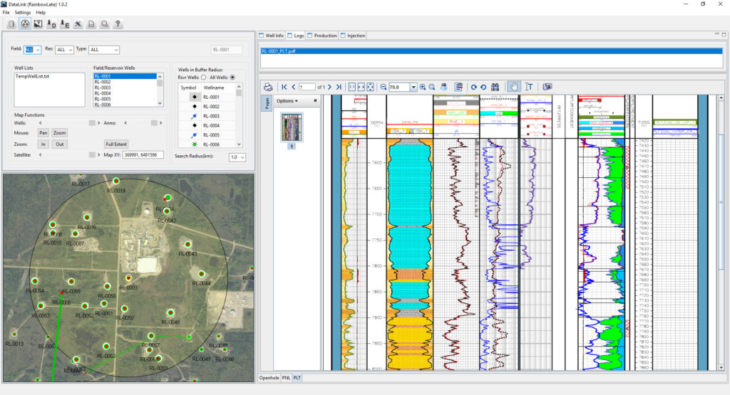
View all wells in the field with their full wellbore trajectories plotted over a satellite georeferenced map.
Build a map with a few button clicks. Overlay a structure grid. Plot bubble maps of individual months for any field/reservoir combination.
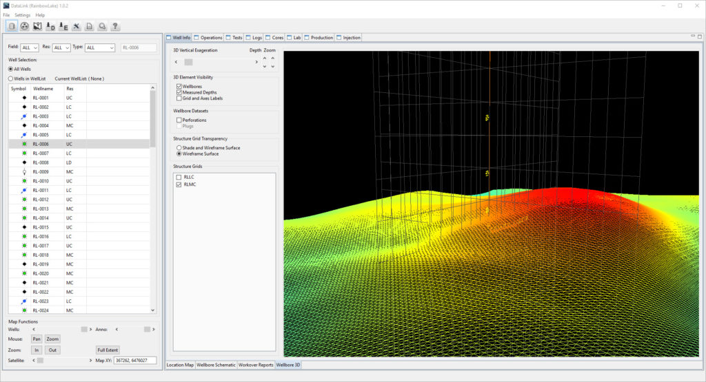
View any grid in 3D in either a solid surface or in wire frame mode.
Use the Offset Wells view to investigate nearby wells. View all Logs for any well by selecting the well from the map.
View multiple grids with any well in an interactive 3D session.,
View the well trajectory in interactive 3D. Rotate, zoom, plot measured depths, grids and axes.
Previous
Next
Integrate tabular data from multiple databases
Interactive plotting of all production data for the well and reservoir
View all the ESP readings for the well in order from most recent to oldest.
View the complete list of open and closed perforations for the life of the well.
View all Open-Close Events for any well. Keep this tab open and select any well to view the new wells Open-Close Events.
Export any tabular dataset from any database with the click of a button to Excel.
Previous
Next
Integrate all historical file-based documents
View all Workover Reports, Daily Drilling Reports, Completion Reports for any well.
View all wellbore sketches for every well. Stay on the wellbore sketch tab and select any other wellname to view its list of wellbore sketches.
Use the Offset Wells view to investigate nearby wells. View all Logs for any well by selecting the well from the map.
View the complete list of PVT , RFT or any other well-specific report.
List and view all core photos and core reports for any well.
Previous
Next
TESTIMONIALS
With DataLink I no longer have to struggle to locate the required data. I simply click on a well and its there. This allows me to explore more potential solutions to our most complex problems.
Reservoir Engineer
DataLink allows an inexperienced engineer like myself to be immediately productive and helpful to the team. I am more interested in my work because I know I am contributing.
RE Trainee
I use DataLink to get a quick overview of the entire problem using all of the available data. This has allowed me to use my other tools more effectively.
Geologist
DataLink saves me hours every day. It allows me to focus more on my work rather than tracking down the data that should just be there.
Production Engineer